Day 3: Polygons
If there’s something that unites motorists in Raleigh - and I suspect in most other US cities - it’s that there is just not enough parking downtown. Is that true? With my map for today’s challenge I don’t suggest I’m answering that question. However, by mapping parking areas bounded by the extent of Downtown Raleigh, I’d like to think this map could help complicate the popular narrative of scarcity.
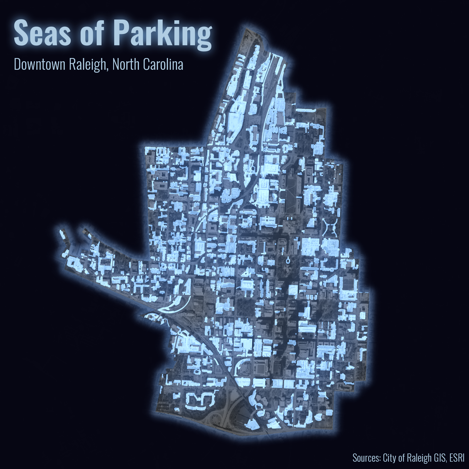
I made this map in QGIS where I continued to play with blending modes, this time applying the Addition to the parking areas layer. It helps give it an icy effect atop the desaturated imagery. I also used an Inverted polygons renderer with a Shapeburst fill for the downtown boundaries. It’s truly amazing what sort of interesting cartographic effects and layouts you can produce in QGIS!