Day 8: Blue
I had originally intended to make a map related to the Bluegrass Region of Kentucky. However, in my search for different definitions of “The Bluegrass”, I came across a really cool map on the Bluegrass Heritage Museums’ website of Clark County, Kentucky.
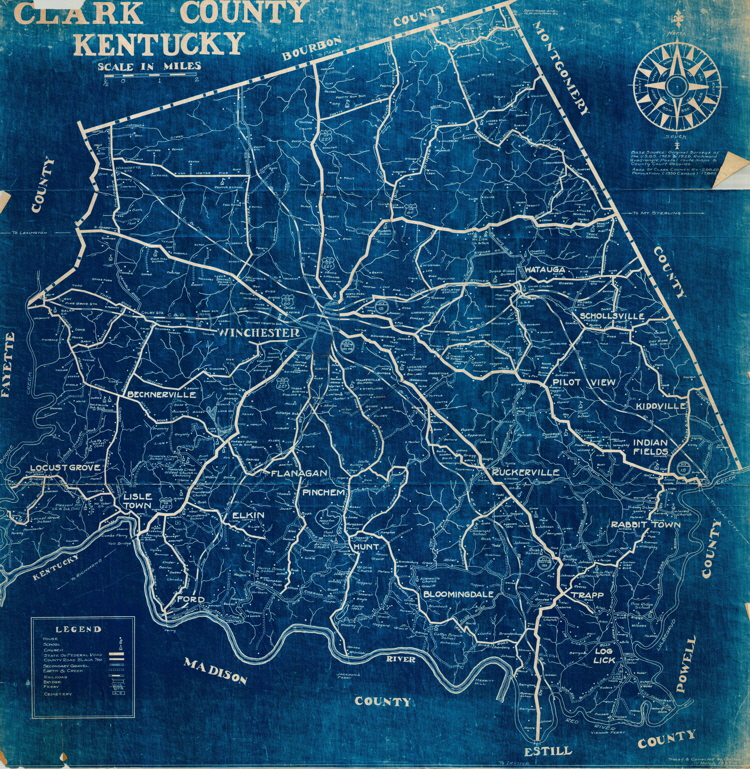
Published in 1937, I believe the blue-white color scheme is less a product of a cartographic movement and stems more from graphic print technique called blueprint .
I decided to use this map as inspiration for a simple map of municipalities of Wake County, North Carolina. Everything in this map was done using QGIS and data from Wake County’s Open Data site .
